
Licensed Land Surveying Services
LoneStar LiDAR delivers a unified geospatial solution by integrating our advanced aerial and bathymetric mapping with licensed professional land surveying. We don't just provide raw data; we offer a complete, legal-grade survey tailored to your specific project requirements. From urban expansion in the Texas Triangle to monitoring coastal subsidence and erosion along the Gulf, our dual-LiDAR capabilities provide the technical foundation for civil engineering, environmental conservation, and complex land development across the state.
Service
Licensed Land Surveying Services
Land Surveying + LiDAR Mapping + Bathymetric LiDAR
Thomas G. Pattison Licensed Professional Land Surveyor Texas RPLS No. 7261

AIRBORNE LIDAR BATHYMETRY
Shoreline Surveys + Shoreline Certificates
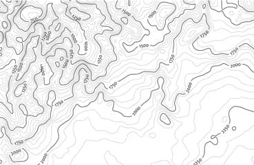
AERIAL TERRESTRIAL LIDAR
LiDAR Drone Topographic Mapping Services

LIDAR MAPPING
Aerial Drone Photo Survey Map Overlay
Texas Land Surveying Services
Thomas G. Pattison
Licensed Professional Land Surveyor Texas RPLS No. 7261
LoneStar: Your Complete LiDAR & Land Surveying Solution
LoneStar offers a comprehensive, “all-in-one” solution for complex projects requiring Bathymetric LiDAR, Aerial Terrestrial LiDAR, and Licensed Professional Land Surveying. Because large-scale LiDAR mapping for urban development, civil engineering, and environmental conservation often requires supplemental field work, we provide a seamless bridge between high-tech data and legal survey standards.
Integrated Land Surveying Services
Beyond our advanced LiDAR sensors, our team of high-tech professionals provides the essential land survey maps that are integral to any major project. In addition to your primary LiDAR deliverables, we offer:
- Legal & Boundary: Metes and bounds legal descriptions, utility easements, and ingress/egress easements.
- Construction & Planning: Topographic mapping and detailed as-built surveys.
Specialized Shoreline & Bathymetric Support
Airborne LiDAR bathymetry projects almost always require precise land survey work on the adjoining coastline or riverbanks. By combining bathymetric and terrestrial LiDAR with our traditional surveying expertise, we provide a “land-to-water” data package. For these specialized projects, our company offers:
- Official Shoreline Certificates
- Shoreline Boundary Surveys & Maps
- High-Resolution 3D Digital Terrain Models
Why Choose LoneStar?
Whether you are planning a coastal infrastructure project or a large inland development, LoneStar ensures your LiDAR project meets all professional surveying requirements. We take you from the initial flight to the final certified map, providing the accuracy and legal descriptions your project demands.
Why LoneStar for Texas Land Surveying Services?
- Thomas G. Pattison, owner, is a Licensed Professional Land Surveyor [Texas RPLS No. 7261] with 40 years of experience.
- We combine LiDAR surveys, aerial terrestrial LiDAR Mapping, and airborne LiDAR bathymetry with our land surveying services for a complete solution for your project.
- Most companies just collect LiDAR data. We provide highly accurate 3D digital terrain models (DEMs) and topographic mapping with our in-house licensed land surveyor.
Ground Truthing LiDAR Data
Precision Ground-Truthing & Professional Oversight
A Licensed Professional Land Surveyor is the essential link between raw data and actionable intelligence. At LoneStar, Thomas Pattison ensures the highest tier of accuracy by rigorously ground-truthing all aerial LiDAR datasets. While LiDAR sensors collect massive amounts of information, the resulting Point Clouds are relative; they must be precisely adjusted to match physical monuments on the ground. For every civil engineering and development project, we ensure all LiDAR data is tied directly into established property corners for legal and structural integrity.
The Technical Advantage: LiDAR vs. Conventional GPS
Our company produces some of the most granular 3D digital models and topographic maps in the industry by leveraging active data. Unlike traditional GPS ground units—which create contours through the interpolation of random shots taken in the field, LiDAR generates real-time, active x, y, z data points.
- Seamless Integration: All LiDAR deliverables are fully compatible with AutoCAD and MicroStation.
- High Density: Rather than “guessing” the terrain between manual points, LiDAR captures the actual surface of the project area, providing a true-to-life topographic map.
Scalability: Saving Time and Budget
Aerial terrestrial LiDAR is the most cost-effective method for mapping large-scale Texas landscapes. By covering vast acreage from the air, we significantly reduce the “boots on the ground” time required by traditional field crews.
- Rapid Deployment: Projects that once took weeks or months using conventional GPS units can now be completed in a matter of hours or days.
- Lower Overhead: Faster data collection translates to reduced project costs without sacrificing the centimeter-level precision required for modern urban development and infrastructure.
Looking for licensed professional land surveying services?
At LoneStar LiDAR, we integrate licensed land surveying with every aerial terrestrial and bathymetric LiDAR project we undertake. By combining traditional ground-truth precision with cutting-edge drone technology, we provide a complete mapping solution that far exceeds the accuracy of standard GPS-interpolated maps.
Our Evolution: Decades of Expertise
Our foundation is built on the extensive experience of Pattison Land Surveying, a firm dedicated to professional accuracy since 2003. In 2006, we expanded our capabilities by launching Aerial Surveying, Inc. to pioneer LiDAR mapping services. Today, we operate as a unified force, merging elite land surveying credentials with the most advanced aerial data collection in the industry. This dual-expertise allows us to provide “sealed” professional surveys backed by high-density LiDAR data.
Texas-Specific Surveying Services
We offer a comprehensive suite of professional services tailored to the Texas land development, energy, and infrastructure sectors:
- Aerial Drone Overlays: High-resolution orthomosaic imagery integrated directly onto all land survey maps for superior visual context.
- LiDAR Topographic Mapping: True-surface modeling that captures every contour, eliminating the “guesswork” of traditional GPS interpolation.
- Certified Boundary Surveys: Professional staking, legal descriptions, and comprehensive survey reports for residential, commercial, and industrial sites.
- As-Built & ALTA/NSPS Surveys: Precision documentation for complex Texas real estate transactions and post-construction verification.
In Addition to LiDAR Mapping we offer a Full Range of Land Surveying Services
Ready to Start?
Let's Map Your
Next Project
Tell us about your site and timeline. We'll respond with a proposal within 1–2 business days.