
Precision Mapping Built for Texas
Sub-centimeter aerial LiDAR surveys, topographic mapping, and 3D point cloud data – delivered on time for engineers, developers, and government agencies across the State.
Request a Quote →
What We Do
Licensed Land Surveying and LiDAR Mapping
LoneStar LiDAR offers Licensed Land Surveying and LiDAR Mapping Services via helicopter or drone for Aerial Terrestrial LiDAR scanning as well as Bathymetric Airborne Drone LiDAR Mapping Services and Sonar or Echosounding Drone Mapping Services.

Land Surveying Services: LiDAR Drone Topographic Mapping
LiDAR technology is transforming how topographic mapping is performed across the surveying industry. With UAV-mounted LiDAR systems, surveyors can now capture high-density elevation data faster and more efficiently than traditional ground-based methods. By directly measuring millions of precise elevation points, LiDAR delivers highly detailed terrain models with superior vertical accuracy. Unlike surface models generated through GPS point interpolation, LiDAR-based topographic maps provide a more comprehensive and accurate representation of existing ground conditions, even in areas with vegetation or complex terrain.
Learn More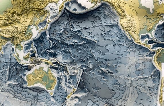
Bathymetric LiDAR Mapping Services
We utilize an advanced dual-function LiDAR system mounted on a gas-powered UAV to collect highly accurate elevation and terrain data across a wide range of Texas landscapes. Our integrated platform captures both bathymetric measurements in rivers, lakes, and reservoirs and detailed terrestrial LiDAR data of surrounding land features. This capability allows us to map floodplains, wetlands, infrastructure corridors, agricultural land, construction sites, transportation routes, and natural terrain with seamless transition between water and land environments. The result is comprehensive, survey-grade data that supports engineering, environmental analysis, land development, and large-scale infrastructure projects throughout Texas.
Learn More
LiDAR Drone Mapping Services
Our advanced gas-powered UAV significantly extends operational flight time, enabling up to three hours of continuous LiDAR data acquisition, far exceeding the typical 20-minute limitation of battery-powered drones. This extended endurance allows us to efficiently survey large and complex project areas in a single deployment. Equipped with a dual-purpose LiDAR platform, our system performs both airborne bathymetric mapping and high-resolution terrestrial LiDAR scanning in one integrated workflow. The result is seamless, survey-grade data collection across water bodies, infrastructure corridors, and expansive land areas, delivering comprehensive elevation and terrain intelligence for demanding projects.
Learn More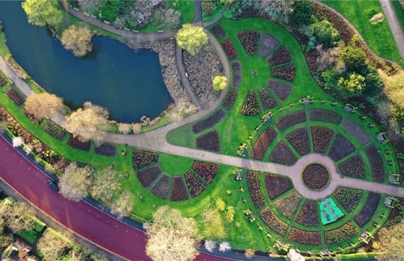
Digital 3D LiDAR Mapping: Georeferenced Orthoimages + Photo Mosaics
Across the diverse landscapes of Texas, LoneStar LiDAR provides the clarity you need through 3D mapping and georeferenced orthoimagery. We convert complex data points into high-resolution photo mosaics, ensuring every acre of your site is represented with professional-grade accuracy and spatial depth.
Learn More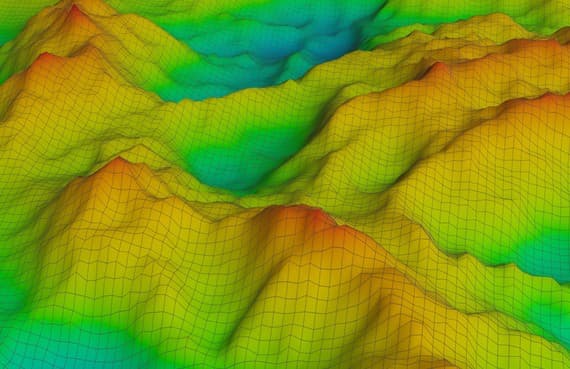
3D LiDAR Modeling: Digital Terrain Models (DTMs) + Digital Elevation Models (DEMs)
For Texas projects requiring extreme precision, our 3D LiDAR modeling converts complex point cloud datasets into actionable terrain intelligence. Whether you need a Digital Terrain Model (DTM) for land development or high-resolution DEMs and DSMs for site analysis, our technology delivers a clear, three-dimensional view of your property’s assets and elevation.
Learn MoreTopographic Maps / Contour Mapping Created from LiDAR Data Point Clouds
Topographic mapping has evolved far beyond traditional aerial photos. Today, LoneStar delivers superior accuracy by leveraging live LiDAR data. Our latest investment—a miniaturized terrestrial LiDAR sensor mounted on a heavy-duty, gas-powered UAV—enables us to map vast Texas acreages and complex terrains that older methods simply can’t match.
Learn MoreWhy LoneStar

The Standard for Texas Surveying
We combine Texas-licensed professional surveyors with the most advanced LiDAR technology available. Giving you data you can build on, file permits with, and trust in court.
Texas-Licensed Professional Surveyors
Every project is sealed and signed by a TBPELS-licensed surveyor. We carry full E&O and general liability insurance across all Texas jurisdictions.
Proprietary LiDAR Fleet
We own and operate our own LiDAR systems. Direct access means faster turnaround.
Statewide Reach, Local Knowledge
Regional office in Austin and expanding across Texas.
Industry-Standard Deliverables
DWG, LAS, GeoTIFF, SHP, and KMZ formats delivered via secure cloud portal. Integrated with Autodesk, Esri, and Bentley workflows out of the box.
How?
What is LiDAR?
From urban development to large-scale surveying, our LiDAR remote sensing technology provides the 3D mapping precision required for complex Texas infrastructure. By capturing active x, y, z coordinates through laser light pulses, we build the framework for exact contour mapping and 3D modeling. Our ability to merge this LiDAR data with high-resolution, orthorectified imagery results in superior photo mosaics. This integrated approach offers a decisive advantage for engineers and land planners requiring the highest level of topographical accuracy.
Texas LiDAR Services
Premier Texas LiDAR Company
LiDAR Services
Land Surveying Services
Reason to Hire “LiDAR Companies Near Me”
Avoid the “middleman markup.” Many national LiDAR firms that take on Texas contracts actually outsource their data collection and laser scanning to local specialists like LoneStar LiDAR. By hiring us directly, you eliminate the subcontracting fees that outside companies tack onto your bill. You get the same elite remote sensing and LiDAR data collection, but without the unnecessary overhead.
FAQ
Frequently Asked LiDAR Questions
Whether your project is over solid ground or submerged terrain, LoneStar has the technology to map it. Our fleet includes gas-powered drones and helicopters equipped for terrestrial LiDAR scanning, as well as advanced UAVs for bathymetric mapping. We also utilize remote-sensing Sonar and Echo sounding technology to deliver precise underwater topographical data for Texas waterways and coastlines.
›Does LoneStar Do LiDAR Drone Mapping?
We provide high-tech, gas-powered LiDAR drone services designed for efficiency. This specialized UAV platform makes professional data acquisition affordable and accessible for smaller-scale project sites.
›What Equipment Does LoneStar Use?
AstraLite Edge a patented 2-in-1 Topographic + Bathymetric LiDAR Mapping System with the following features:
- Cutting-edge Airborne LiDAR Bathymetry System that now solves the limitations of traditional Bathymetric or SHOALS systems.
- For the first time ever, measuring underwater features at centimeter-level depth resolution is now possible.
Rock Robotics R2A LiDAR System a complete LiDAR + RGB Solution with the following features:
- Complete aerial terrestrial LiDAR mapping solution.
- Equipped with the new Livox Avia sensor with a Novatel GNSS high-accuracy Inertial Labs IMU.
- Equipped with a 24MP Sony camera for high resolution aerial photographs for georeferenced orthoimagery.
Riegl 280ii LiDAR system manufactured from a series of major components:
- Laser 600-1000 nm LiDAR lasers are common.
- Scanner dual axis scanner.
- Photodetector solid state photo detectors.
- Navigation System- GPS Global Positioning System.
- Equipped to LiDAR Helicopter.
Our new gas-powered SkyFront LiDAR drone flies up to 3 hours now making it possible to collect bathymetric LiDAR data point clouds over the open ocean. We also use our gas-powered drone for mapping aerial terrestrial LiDAR projects of 500 acres or less.
›Does LoneStar Provide High-Resolution Photo Mosaic?
LoneStar employs cutting-edge stitching software to generate orthorectified photo mosaics. These high-resolution images are corrected to match your project’s ground coordinates precisely, providing a true-to-life aerial perspective.
›Does LoneStar Do Bathymetric LiDAR?
LoneStar specializes in Airborne LiDAR Bathymetry for civil engineering, coastal mapping, and flood plain analysis. Our hydrographic data supports shoreline erosion control, sea-level research, and underwater terrain mapping for environmental conservation.
›Does LoneStar Do Aerial Terrestrial LiDAR?
We utilize R44 helicopters for large-scale terrestrial mapping and specialized gas-powered drones for projects under 500 acres. LoneStar produces detailed contour maps and topographic surveys tailored to your specific acreage.
›How does LoneStar Collect LiDAR Data Point Clouds?
By mounting sensors on gas-powered drones or helicopters, we capture precise elevation data for topographic mapping. We integrate this data with high-resolution orthoimagery to produce accurate photo mosaics and 3D visualizations.
›How Do LiDAR + Orthorectified Images Come Together?
Our team utilizes laser scanning to merge georeferenced aerial photos with LiDAR datasets. Every project includes high-resolution orthoimages and accurate photo mosaic maps as standard deliverables.
›How Does LiDAR Laser Scanning or Remote Sensing Work?
LiDAR uses laser light to pulse and measure distances across various surfaces. Collecting data from drones or helicopters, we achieve a minimum resolution of 3cm, providing limitless possibilities for remote sensing and land surveying.
›What Laser Scanning or Remote Sensing Data is Collected?
Our LiDAR company uses a state-of the art LiDAR scanners mounted on either a helicopter or gas-powered drone collecting the following AutoCAD compatible LiDAR data:
- First Return LiDAR Data Point Clouds.
- Second Return LiDAR Data Point Clouds.
- Third Return LiDAR Data Point Clouds.
- Fourth Return LiDAR Data Point Clouds.
- Active x, y, z Data Points
- Georeferenced LiDAR Data Point Clouds
- AutoCAD + MicroStation Compatible Data
›Is Your LiDAR Data AutoCAD + MicroStation Compatible?
LoneStar’s LiDAR Mapping systems collect active x, y, z data points in real time. LoneStar LiDAR produces AutoCAD + MicroStation compatible x, y, z data points. Our LiDAR Data is superior to interpolated data generated with Photogrammetry.
›Are your High Resolution Orthorectified Images Geo-referenced?
Every LoneStar project includes georeferenced orthoimages that combine photographic detail with map-grade geometry. To ensure absolute precision, all images are ground-truthed by our in-house surveying department.
›What is the History of LiDAR?
Founded in the late 1950s, LiDAR technology was discovered shortly after the laser was invented. Laser scanning was combined with laser focused imaging to calculate distances by measuring the time it takes the laser beam to return. LiDAR is an acronym originating from the terms “light” and “radar”. LiDAR as an acronym for Light Detection And Ranging began in the 1970s as the true definition of LiDAR.
Ready to Start?
Let's Map Your
Next Project
Tell us about your site and timeline. We'll respond with a proposal within 1–2 business days.