
Aerial Terrestrial LiDAR Mapping Services
LoneStar LiDAR provides versatile aerial terrestrial mapping through both high-endurance helicopter laser scanning and agile drone remote sensing. Our advanced UAV platforms have democratized high-precision data, making professional LiDAR topographic mapping accessible and cost-effective for projects of any scale. From small-acreage developments to expansive municipal tracts. This technology is the premier choice for Texas-based civil engineering, urban planning, environmental stewardship, and professional land surveying.
Service
Texas Aerial LiDAR Mapping Services
LoneStar LiDAR delivers high-density geospatial data that serves as the backbone for Texas civil engineering, professional land surveying, and large-scale urban development. By utilizing airborne laser scanning, we significantly reduce “boots-on-the-ground” time, allowing for rapid data acquisition across vast acreages. This streamlined field phase directly translates into lower project overhead and accelerated timelines, making our LiDAR solutions a strategic asset for environmental conservation and post-disaster recovery efforts.
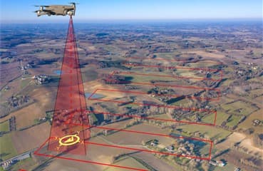
LIDAR DRONE MAPPING
Aerial Terrestrial LiDAR Drone Mapping
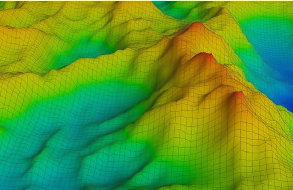
3D MAPPING LIDAR
Digital 3D Models + Orthorectified Images
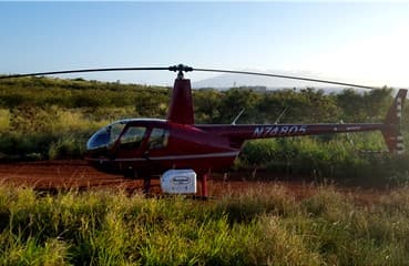
MAPPING WITH LIDAR
Aerial Terrestrial LiDAR Helicopter Mapping
LiDAR Mapping Services – The Smart Solution
LoneStar LiDAR provides a high-speed alternative to conventional ground surveying. By deploying helicopter-mounted laser scanners, we can complete expansive topographic projects in a matter of days, tasks that typically take weeks or months using traditional robotic total stations or manual GPS points. This transition from “boots on the ground” to aerial remote sensing significantly compresses project timelines and reduces overall mobilization costs.
The Next Generation: 2-in-1 Drone Integration
We have pioneered a more accessible way to capture complex data by integrating our cutting-edge 2-in-1 LiDAR system onto high-endurance, gas-powered drones. This platform allows us to perform both terrestrial and bathymetric LiDAR mapping simultaneously. Unlike legacy SHOALS systems, which require large, cost-prohibitive manned aircraft, our UAV-based approach makes high-resolution laser scanning affordable for projects of any scale.
Precision Bathymetry & Coastal Resilience
Our specialized blue-green laser technology penetrates the water column to map submerged features and seafloor topography at a centimeter-level depth resolution. This dual-system capability is the premier choice for Texas infrastructure and environmental protection, including:
- Civil Engineering: Precise data for coastal construction and port authority projects.
- Erosion Monitoring: Tracking shoreline recession and the impact of storm surges along the Gulf Coast.
- Disaster Recovery: Rapidly mapping inland flooding or hurricane damage to aid in state and local response.
- Submerged Asset Mapping: Identifying underwater terrain and features in clear lakes, rivers, and coastal margins.
Why Choose the LoneStar Approach?
By replacing traditional SHOALS and manual surveying with our gas-powered drone technology, we provide a seamless “land-to-water” digital model. Whether you are managing urban development, environmental conservation, or a complex maritime project, LoneStar LiDAR delivers the granular data you need at a fraction of the traditional cost and timeframe.
LoneStar Mapping with LiDAR
- LiDAR Mapping your large project via helicopter saves time in the field.
- LiDAR Drone Mapping is a cost effective solution for LiDAR Mapping.
- LiDAR Mapping is perfect for topographic mapping, civil engineering projects, land surveying projects and urban development.
- LiDAR Mapping produces active x, y, z data points which are AutoCAD + MicroStation compatible.
What is LiDAR?
LiDAR, an acronym for Light Detection and Ranging, is a sophisticated active remote sensing technology. Unlike passive imaging, LiDAR utilizes a high-frequency laser beam to penetrate dense vegetation and canopy cover, allowing for the precise mapping of land contours across vast acreages. This makes it an exceptionally cost-effective solution for generating high-resolution topographic maps in areas where traditional ground surveying would be obstructed by brush or overgrowth.
Data Acquisition & Ground Measurement
The process begins with a rapidly firing laser system that emits light pulses toward the earth's surface. These pulses are capable of threading through foliage to reach the ground, while also reflecting off physical structures such as rock outcroppings, buildings, and tree trunks. Once this light energy bounces back to the sensor, the system records the precise “round-trip” travel time.
From Light Pulses to 3D Coordinates
To transform these light pulses into a functional 3D map, the system calculates the exact distance traveled by the laser. This data is then processed through three critical components:
- Global Positioning Systems (GPS): Synchronized with satellites to pinpoint the exact location of each data point.
- Inertial Measurement Unit (IMU): Constantly monitors the pitch, roll, and heading (orientation) of the aircraft or drone to maintain spatial integrity.
- Elevation Processing: The calculated distances are converted into highly accurate x, y, z coordinates, forming a comprehensive “Point Cloud” of the project site.
LoneStar LiDAR Systems
At LoneStar LiDAR, we don't just collect data; we validate it. By utilizing our state-of-the-art laser scanning systems, we provide high-fidelity deliverables that are meticulously verified. Our in-house Licensed Professional Land Surveyor performs rigorous ground-truthing on every dataset, ensuring your digital LiDAR model perfectly aligns with the physical reality of the project site. This professional oversight is the bridge between raw remote sensing and survey-grade precision.
The LiDAR Advantage: Active Data vs. Interpolation
Traditional mapping methods, such as manual GPS shots or Photogrammetry, rely on interpolation. This means a field crew takes a limited number of “shots,” and the software “guesses” the elevation for the space in between.
In contrast, LoneStar LiDAR utilizes active laser technology to capture real-time, high-density x, y, z data points.
- Active Remote Sensing: Our sensors physically “touch” the surface with laser pulses thousands of times per second.
- True Surface Modeling: Because we capture the actual terrain rather than an average, our topographic maps offer a level of detail that traditional robotic total stations simply cannot match.
Operational Efficiency & Cost Control
Time is a critical variable in any Texas civil engineering or urban development project. By transitioning from “boots on the ground” manual surveying to aerial LiDAR, we significantly compress the field-work phase.
- Rapid Acquisition: Large acreages that previously took weeks to map with GPS can now be scanned in a single day.
- Lower Project Overhead: Reducing time in the field directly lowers your total project costs, providing a smarter, faster solution for topographic mapping without sacrificing centimeter-level accuracy.
Equipment
Our LiDAR Mapping Equipment is listed below:
LoneStar offers LiDAR Mapping Services via helicopter or drone for Aerial Terrestrial LiDAR scanning as well as Bathymetric Airborne Drone LiDAR Mapping Services and Sonar or Echosounding Drone Mapping Services.
›AstraLite 2-in-1 Airborne LiDAR Bathymetric & Aerial Terrestrial LiDAR System
›Riegl 280ii Laser Scanner aka Remote Sensor
›Rock Robotic Aerial Terrestrial LiDAR System
›SkyFront Gas-powered Drones
LoneStar Services – LiDAR 3D Models + Orthoimages
LoneStar LiDAR Mapping Deliverables are among the best in the LiDAR mapping business. Our in-house licensed land surveyor ground truths all LiDAR data to ensure its accuracy in relation to your project. LiDAR Mapping collects active x, y, z LiDAR data point clouds in real time. All of our LiDAR data is AutoCAD + MicroStation compatible. Learn more about our digital 3D models and orthorectified imagery deliverables.
›LiDAR 3D Modeling + Orthoimage Deliverables include the following:
- Digital Terrain Models
- Digital Elevation Models
- 3D Maps
- 3D Models
- Orthoimages
- Multi Spectral Images
- Photo Mosaics
- High Resolution Geo-referenced Aerial Photos
- Topographic Maps
- DTMs
- DEMs
- High Resolution Aerial Photographs
- LiDAR Data Point Clouds
- LiDAR Data 1st Return
- LiDAR Data 2nd Return
- LiDAR Data 3rd Return
- LiDAR Data 4th Return
- AutoCAD Compatible LiDAR Data Points
- MicroStation Compatible LiDAR Data Points Active X, Y, Z Data Points
- LiDAR Drone Photos
Ready to Start?
Let's Map Your
Next Project
Tell us about your site and timeline. We'll respond with a proposal within 1–2 business days.